LiDAR/Survey
AG3 understands the need for experienced, quick-response surveying teams. We have brought together a team consisting of Registered Professional Land Surveyors (RPLS), LiDAR Technicians, Pilot Certified UAV (Drone) personnel, GIS specialists, survey crews and survey technicians. Our team of surveyors have the experience and capabilities to provide thorough, accurate, and precise surveying services.
Our firm currently has Prime Survey TxDOT contracts with the El Paso and San Antonio Districts. AG3 has also been selected as a subconsultant with other firms on various state, county, city, and municipality projects.

Close Range Aerial Photogrammetry
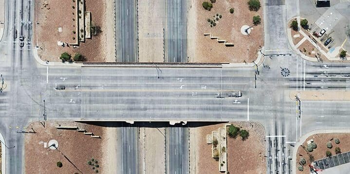
TxDOT Artcraft Bridge crossing IH-10, El Paso, TX
AG3 Drones have the ability to deliver high accuracy 2D Ortho Photos as well as a 3SM files for Reality Meshes. The video editing staff can record 4K video for inspection of towers and wires as well.

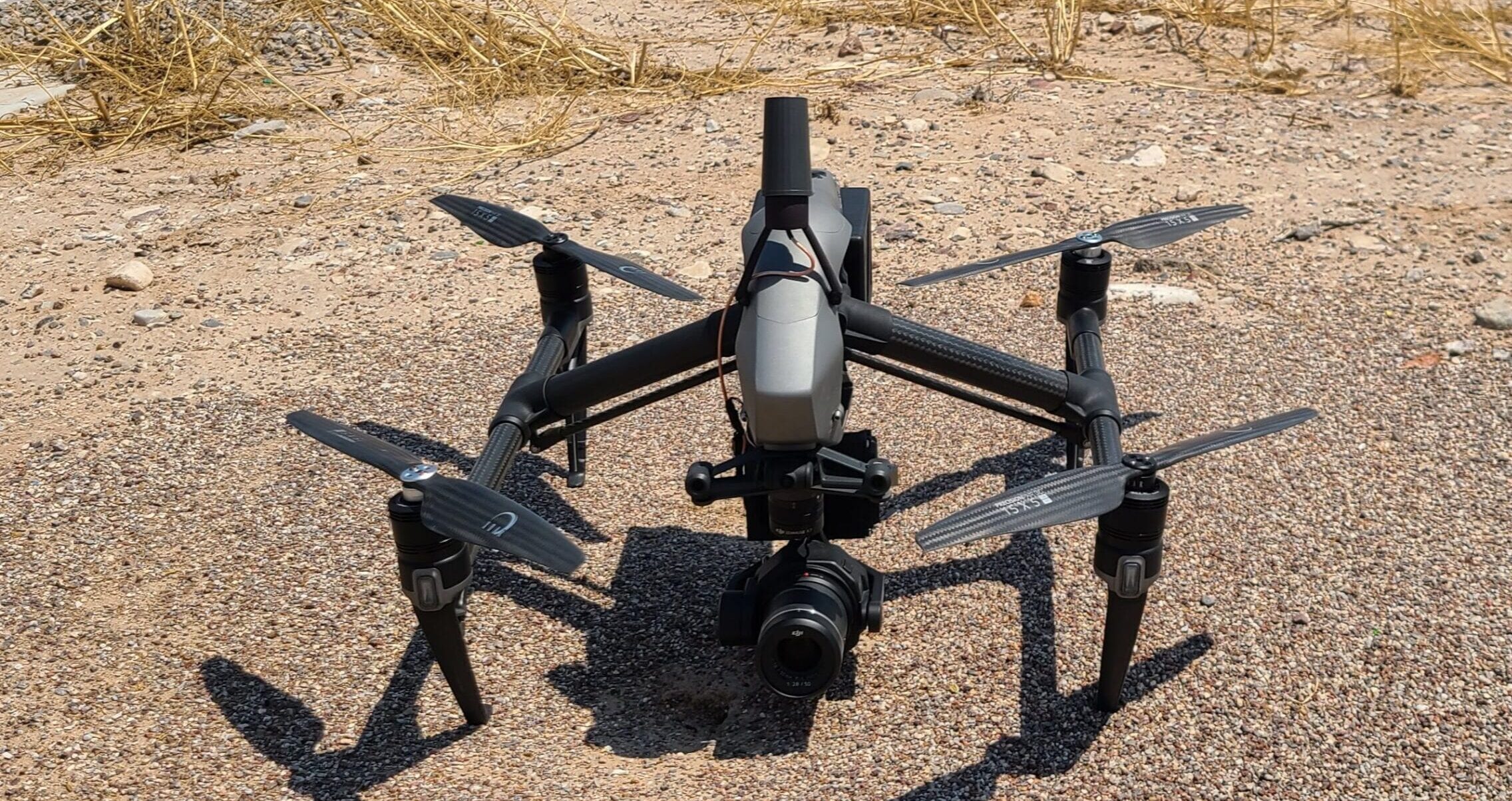
AG3 DJI Drone

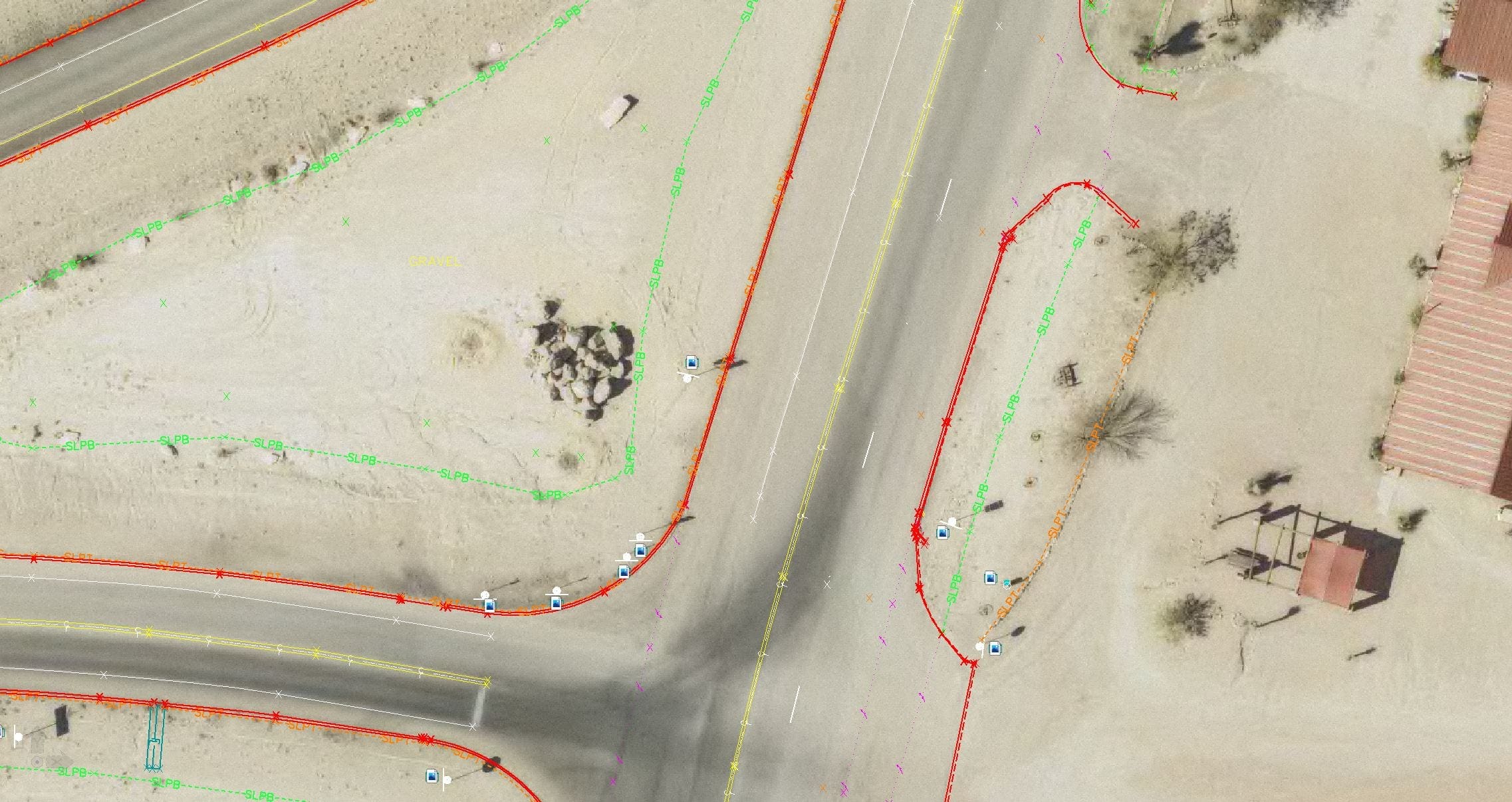
Drone imagery merged with line work.
Reinforcing Your Projects Utilizing AG3 Technology
AG3 LiDAR/Imagery technology offers our clients immediate and tangible benefits on a wide range of projects. These high-density scans (HDS) and Close Range Imagery photos are able to collect complete 3D models of a project site, with every laser point connected to survey-quality X, Y, Z coordinates, as well as high-resolution digital imagery for simple and comprehensive image-assisted documentation. This allows our technicians to respond to additional site survey needs on-the-fly, without requiring time consuming (and potentially costly) site mobilizations.
Examples of these tangible benefits include:
- The ability to perform Survey work without the need for Right of Entry
- The ability to Survey areas that are inaccessible to Survey crews (Building roofs, Refineries, waterways, etc.)
- Quickly and safely collect data for busy streets, intersections and bridges
How AG3 Engineering Processes and Geospatial Technology
will benefit your projects:
Geospatial Services – Enhance Your Engineering and Survey Project Workflows
AG3 has been able to devise a unique proprietary method throughout the project workflow from survey to design, through construction, resulting in a final coordinate correct as-built CAD deliverable. This method has been achieved as a result of early adoption of LiDAR technology in collaboration with our insightful engineering knowledge,
These proprietary methods have allowed AG3 clients to better utilize these vast amounts of information made available through Drone Imagery and LiDAR Scanning.
AG3 is organized and managed as a cross-functional team where each member of both the Engineering and Geospatial group contributes their expertise and focus to specific client needs. This management structure combined with our unique methods moves projects forward with speed, accuracy and cost effectiveness.
AG3 Survey and LiDAR Services Include:
• Global Positioning System (GPS) Surveys
• LiDAR Surveys
• UAV (Drones)/Photogrammetry
• Geographic Information system (GIS) analysis
• Boundary Survey
• Utility Survey
• Topographic Survey
• Tree Surveys
• Transmission Lines
• Right-of-Way and Easement Surveys
• Civil Design
• Construction layout
• As-built Surveys including underground assets
• Mass quantity takeoffs
• Construction Staking
• Land Title Surveys (ALTA/ACSM and TSPS Cat. 1A)

